The Warwick Project team are honored to have been granted the privilege by the Explorers Club to carry Flag #132 into the field. Since 1948, Flag # 132 has been carried on various expeditions from Patagonia to the Hindu Kush. Flag #132 has already seen its share of nautical archaeological field work having flown over Dr. Robert D. Ballard’s 1998 search to find the German battleship “Bismarck”, Peter E. Hess’s 1990 “USS Monitor Expedition”, David Concannon’s 2001 “Atlantic Sands” and the 2003/5 “R.M.S. Titanic Scientific & Photographic Expeditions”.
The Warwick Project in the News:
Royal Gazette March 2011
Royal Gazette, July 2011
ECWG
Nautical Archaeology Society Winter 2011 newsletter
BIOS Video Documentary
2011 GEOS Foundation Grant:
The GEOS Foundation Grant is awarded by the Society to emerging scientists who through their work seek to further our understanding of our world.
Piotr Bojakowski examining artifacts recovered from the Warwick
The 2011 Fitz Roy Fellowship has been awarded to Piotr Bojakowski, Co-Director of the Warwick Project; PhD Candidate in the Nautical Archaeology Program at Texas A&M University in recognition of his work to increase our understanding of 16&17th century naval architecture as well as his desire to raise awareness and foster a sense of stewardship for Bermuda’s underwater cultural heritage.
Project Log:
The Warwick Project dive platform
19 July 2011
Conclusion
For the last few days Bermuda has finally gotten some much needed rain. However, this front has brought with it wind and cold temperatures which has made work difficult. With many of the project team having flown out on Friday or Saturday, only Kroum, Susi, Mike and Piotr, plus two local volunteers remained to battle constant rain and chilly working conditions.
Like all TAMU / Institute of Nautical Archaeology scientific excavations, The Warwick Project rigorously adhered to the procedures established for scientific excavations. As Dr Batchvarov explains: “these procedures begin with the careful excavation by water dredge and documentation in situ by photography and measurement of all artifacts lying on the bottom. Only after an object has been photographed, documented by underwater photography and plotted accurately on the site plan using the latest digital software, is consideration given to removing the object from the site for conservation and display”. * N.B. It is the Government of Bermuda’s policy that all objects recovered remain the property of the people of Bermuda. “While not engaged in the excavation underwater, members of the excavation team will work on the surface to catalogue every object raised from the site and begin the process of field conservation”. At the conclusion of each season the site must be protected from exposure to currents, worms and other agents which could damage the site. Typically this process starts with covering the timbers with sand and silt. In this case this was accomplished using the blue half-barrel we have on site and small buckets. Despite this work, Piotr decided that the site needed to be further protected with a tarp. The team prepared the tarp on the surface and took it down. One edge was weighted with lead weights.
After positioning it, the team slowly started to unroll it while Jillian, Sam, and Susi placed large stones all over it; which were prepared prior to the tarp. Using everyone available, the tarp was weighted down. It is hoped that the trap will provide the anaerobic conditions and slow the deterioration of the timbers. After this Piotr decided to run a dredge for 2 more dives to bury the tarp. This provided a uniform layer coverage. Because some parts, especially along the top, were still not fully buried, during the last dive the team used a blue bucket and put a few loads of sand over the exposed sections.
Having now completly reburied the site exposed, the fieldwork part of the project for 2011 is complete.
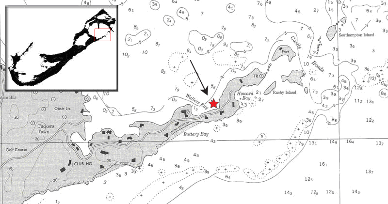
13 July 2011
Case Harbour
Sea Surface: winds: 5-10knots
Visibility: 1-3m
Over the last few days our work platform has been taking on water and is listing despite attempts to pump out the bilge. This morning James Davidson our marine Engineer was able to use one of our dredgers to pump out excess water from the bilge which appears to have stabilized the barge for the time being:
James Davidson and DSO Mike Gilbart at work
With repairs done, Dr. Kroum Batchvarov and his assistant Susana Vallejos began a detailed hull measurements on the Warwick. Dr Batchvarov describes his methodology here:
This system was designed by Dr. Batchvarov and first used on the Vasa in Sweden.
This innovative technique uses sticks placed between planks to obtain an accurate measurements:
Work also continued away from the hull where we excavated a number of metal objects and concretions including more bar shot:
Concretions of bar & musket shot
12 July 2011
Case Harbour
Sea Surface: winds: 10-15knots
Visibility: 3-5m
Tuesday morning was spent with tape measurers, pencils and clip boards of mylar paper. Mid day our friends from BIOS brought another group of students out to the site to snorkel and dive above the archaeologists at work.
In the afternoon we recorded and excavated a pintle discovered by James Davidson a few days ago. A pintle is a pin or bolt inserted into a gudgeon like we excavated yesterday which is used as a pivot ot hinge and could be used to keep the rudder attached to the boat. In the afternoon we received a visit from the young crew of the sail training vessel Spirit of Bermuda.
Sail training vessel Spirit of Bermuda
While the crew of young Bermudians got to see firsthand the archaeologists bring up a 400 year old pintle, our team admired the beautiful lines of their Bermudian-type schooner which is a replica of the type of vessel built in Bermuda between 1810 and 1840.
11 July 2011
Case Harbour
Sea Surface: light waves, winds: 12-18knots
Visibility: 1-3m
With the weather closing in on us, Dr. Adams, Dr. Batchvarov and Project Director Piotr Bojakowsi, Susana, Maureen, Mike and Danny spent the morning recording and measuring timbers:
Meanwhile using DSM, James and Jason recorded a number of objects identified with a metal detector including a lead sheet and a meter long “nail”:
James recovering a nail:
Jason raising a concretion:
In the afternoon a large concreted mass was brought up to the barge which contained a handle shaped object which is wrapped with a metal wire:
10 July 2011
Case Harbour
Sea Surface: light chop, winds: 10-15knots
Visibility: 1-3m
Sunday was slated to be more cleaning of the hull with the dredger. As you can see in this video the exposed structure is substantially cleared and we can get a sense of the framing details of the Warwick:
This morning James and Maureen recovered a concreted mass containing with at least three cannon balls as well as munitions called expanding bar shot. Maureen explains:
concretion of cannon balls
Surprisingly when the Project Director started to remove concreted materials from one of the canon balls the outer shell split into two halves releasing a beautifully preserved iron cannon ball:
aprox 400 year old cannon ball
Piotr identified a long concretion which has the shape of a sword:
sword shaped concretion
Another significant artifact brought to the surface today was a metal fitting called a gudgeon. This device allows for the pivoting of another fixture such as a rudder when used with a pintle :
Piotr has decided that excavation work will cease today so that we can have we have enough time to fully record the uncovered section of Warwick prior to reburial for the season.
6 July 2011
Case Harbour
Sea Surface:
Visibility:
Students from the Bermuda Institute of Ocean Sciences visited this morning, along with their teachers and Elena Strong of the Bermuda Maritime Museum. Follow this link to find out more about the amazing programs and research going on at: BIOS
The group of ten 12 – 16 year olds really impressed us with their enthusiasm and questions. Students dove on the wreck to watch archaeologists at work, spoke with DSO Mike Gilbart about the artifacts found on Warwick and with assistant director Doug Inglis about how archaeology brings science and history together.
Danny and Piotr are recording a waterway (part of the edge of the deck structure) that was loose. (Above)
This artifact was used to show students how small details give important clues to how the boat was built and used. To protect the fragile timbers, loose planks are carefully placed on the seafloor beneath the barge.
Maureen recording the Ceiling Planking (Above).
While BIOS was here, the crew continued recording the hull. Thanks to our boatload of archaeologists, recording is going much faster than anticipated. We decided to expand the site, and began dredging in the afternoon. We are excited to see what will turn up!
Things that turn up: A Gecko joined on the barge (Above). James rescued it, and gently put it ashore
In the evening, Dr. Crisman gave a lecture for the residents and guests of Tuckers Point Hotel about the projects he directed in the Azores.
-DI
5 July 2011
Case Harbour
Sea Surface: calm
Visibility: 3-5m
The dive boat (Above) arriving to pick us up.
This morning we were joined by Robert Zuill, who filmed divers as they recorded the wreck, move coral and ballast with lift bags and excavated a concreted chain plate. We are thrilled to have him participating. Just after Robert left the site, we found, mapped and raised a large concretion of cannonballs.
Longtails fly over the dive barge and boat (Above).
After Warwick wrecked, parts of the hull were salvaged, and other parts left to fall apart on their own. There are numerous loose deck planks on the wreck, lying haphazardly across the beams and top timbers. Although not necessarily in their original position, these planks can be great sources of information. Archaeologists traced them on clear plastic acetate, recording important features such as fasteners, tool marks and grain pattern. These minute details provide significant information on how the ship was designed and built.
Dr. Adams, Dr. Batchvarov and Project Director Piotr Bojakowsi gave public lectures at the Aquarium in the evening. Some 80 people crammed in between the tanks of fish to learn about three incredible shipwrecks, the Sea Venture (Adams), Vasa (Batchvarov) and Warwick (Bojakowski). Were thrilled with the turnout, and owe a debt of gratitude to both the Bermuda Maritime Museum and the Aquarium.
-DI
4 July 2011
Case Harbour
Sea Surface:
Visibility:
It is July 4th. Fireworks are going off here in Bermuda, celebrating the American War of Independence. Somewhat ironically, we spent the day recording a shipwreck that is a reminder that the early North American colonies were completely dependent on the British Empire. When Warwick sank in Bermuda, it was devastating blow to the Jamestown community. Warwick was a key link in the lifeline that connected colonial Virginia, Bermuda and England.
Dr. Kevin Crisman and Dr. Kroum Batchvarov joined us today, working alongside Dr. Jon Adams. With this trio of esteemed Nautical Archaeologists onboard, it was time to start recording the ship. Divers labeled timbers, laid out baselines, and got to work recording the hull.
Attacking the wreck from both ends: Dr. Crisman (Above) is busy drawing the top timbers while Dr. Batchvarov and Susana (Below) are recording the bottom.
We continued exploring east of Warwick’s stern with the metal detector. We began excavating a large concretion of bolts, wood and other metal objects. If we are able to raise it, will have to use an x-ray to see what is inside. We also recovered some lead shot and a powder charge, sometimes referred to as an Apostle.
James Davidson (Above) is using a metal detector to make sure that no musket ball or powder charge is missed.
-DI
2 July 2011
Tuckers Point Base Camp
Sea Surface:
Visibility:
Outside help: Rodrigo Torres shows a young Bermudian how to record artifacts.
The hardworking crew spent part of their weekend recording artifacts! I owe them a debt of gratitude! Thank you everyone – Doug Inglis, Assistant Project Director1 July 2011
Castle Harbour
Sea Surface: calm
Visibility: 5-7m
Flag #132 behind the chain plate of the Warwick
Our objective for today was to finish cleaning the hull so that recording could begin next week.
In this clip the treenails are visible:
The uncovered section of the hull is now cleared of ballast pebbles and debris:
Recording the Chain plate in situ
Today also turned out to be an exciting day of significant finds for the team.
Maureen and Pitor examing important wood artifacts recovered from the screens
Using a metal detector James and Maureen recovered a large concretion located to the north west of the wreck which has numerous musket shot and other ferrous artifacts:
Piotr raised loose deck planking which were brought to the surface to be recorded in a 1: 1 scale on Mylar paper and then reburied:
Piotr and Rodrigo recording sections of planking on Mylar
While dredging Rodrigo uncovered a nearly complete clay pipe:
James recovered a concreted iron bar
A comb made possibly of bone was recovered from the screens:
As was a nice example of Roman era pottery known as Terra Sigilatta or ”small figures” for the markings etched into the pottery. This artifact may have ended up in Bermuda as part of Warwick’s ballast- which was likely to have been dredged rock from English rivers.
Here Dr. Adams explains how roman pottery makes its way to Bermuda:
30 June 2011
Castle Harbour
Sea Surface: calm
Visibility: poor visibility on the sitThe team was joined today by Professor Jonathan Adams who is the Head of Archaeology at the University of Southampton.
Dr Adams is a specialist in maritime archaeology and was the Deputy Director of the Mary Rose Project, the Amsterdam (UK), and the Sea Venture (Bermuda).
Significant progress was made on removing rock ballast from the exposed timbers today.
The overburden around a chain plate and deadeye has been cleaned:
We will try to recover it in the next few days:
After that we plan to start cleaning the remaining and from the timber and start recording next week.
Using a metal detector James and Maureen recovered a lead weight, an excellent example of a musket charge cap, an unidentified lead strip, and a ball padlock similar to what was recovered from the Sea venture.
29 June 2011
Castle Harbour
Sea Surface: light chop
Visibility: approx 5 declining to 3m
Prior to commencing work on the wreck this morning, we made a photo survey to record progress over the last few days:
Once the recording was complete, we had to preform some routine maintenance on one of the dredgers:
With repairs we completed it was back to clearing the overburden:
While much of the structure remains in place on the sea floor, occasionally an artifact is dislodged. If it can not be associated with its immediate surroundings, the item is carefully recovered, brought to the surface, recorded and measured and then either conserved or reburied. Here Pitor the project director is bringing to the surface a wooden artifact for recording:
On the surface items are quickly analyzed and then placed back into tubs filled with water to minimize exposure to air :In the afternoon we did a survey of the area forward of the uncovered hull with a metal detector.
A number of concretions were discovered and other possible targets marked for future testing:
28 June 2011
Castle Harbour
Sea Surface: light winds
Visibility: approx 3m
We are making good progress clearing the over burden so our first task of the morning was to to reposition the dredgers:
Visibility was not great in the morning but improved during the day:
Screening work continued as the dredgers uncover more of the wooden hull:
we recovered a wide variety of artifacts:
including a number of loose wood pieces with nail holes:
Mike The DSO on watch over the divers from the barge
27 June 2011
Castle Harbour
Sea Surface: light winds
Visibility: approx 3m
When the Warwick sank, it took with it the supplies and stores bound for the Jamestown colony. As we continue to clear ballast more artifacts are recovered:
From the morning dives we brought up what might be a clay pipe fragment:
pottery shards:
a round wooden disk shaped object:
a treenail:
and a small “pick shaped wooden fragment:
Early afternoon dives brought up large amounts of coal and a number of wooden wedges. A large animal bone was also recovered.
By the end of the day we had most of the exposed ballast pile removed from the site.
Piotr recording on the exposed section of the hull:
more of the exposed hull:
26 June 2011
Castle Harbour
Sea Surface: calm
Visibility: approx 3-5m
Flag #132 on the Dive barge with the INA signal and Texas A&M flag
After a 8am debrief, we headed out to the site, where the project team which includes Piotr, James, Maureen, Doug, Leah, Danny and Mike got down to work clearing ballast from a midship.
The afternoon dives were spent on the screens sifting through debris which has been carefully excavated from the hull. In addition to clay pottery shards, we found more animal bones:
We also found a number of wooden strips of ash branches called “withies” that were used to instead of iron or copper bands around the staves making up a barrel. Here is an example of a withie being excavated:
25 June 2011
Castle Harbour, Bermuda
Sea Surface: calm
Visibility: approx 3m
I arrived on island this afternoon and headed down to Tucker’s Point Dive & Water Sports Centre, to check in with the owners: Terry, Dawn and Heidi. Terry and company have long been supporters of the The Warwick project; going back to the first assessment surveys. We are all extremely grateful for their continued generous assistance. After catching up, I headed out to test out my gear and make sure the video camera is working as we hope to start recording the site Sunday morning if the weather cooperates.
23 June 2011
Today, the team reports that they found some cannonballs.
15 June 2011
The Warwick Project is underway and the project team has already started to uncover the overburden on the mid section of the wreck (starting where they left off in 2010) and have located a massive ballast pile full of new artifacts such as plate shards, bones (perhaps they are cattle bones which could have been provisions in a barrel that burst). Most importantly under the ballast pile and remaining overburden lies the starboard section of the vessel from the turn of the bilge to the gun wale. This is pretty amazing as this part of the wreck has never been recorded sitting untouched on the bottom of the ocean since 1619..
11 June 2011
The project team arrives in Bermuda and starts to prepare the barge, equipment and dredging the over-burden covering the section of the ship to be recorded this season.
10 September 2010
Stoney Cove, UK
In preparation for this project I flew to the UK to participate in course in Foreshore and Underwater Archaeology run by the Nautical Archaeological Society. This is an exceptional 3 day training session which includes sections on:
Area Search and Survey Methods – Locating and exploring a site
Project Safety and Logistics – Working a site
Introduction to 3D Survey – Surveying a site
Participant Project Planning Session
Dealing with Finds – Artifacts from a site
Participants Present Project Plan
Practical Session 2 – Recording a site
Creating a 3D Plan – Start to plan a site
NAS Training Course in Maritime Archaeology held at Stoney Cove, UK( f.l.t.r: Batuhan Celik, an Archaeologist from Turkey, NAS course instructors Sara Hasan , Ian Cundy, and JP) not pictured NAS instructor Dave Johnston, Photo: B Celik
The hands on sections of this course were particularly useful and after a number of “dry runs” on shore perfecting our technique in recording a site using offsets and Trilateration ,we dropped down into the water to set our control points and take measurements which would later be input into “Site Recorder” a Geographic Information System (GIS) and Information Management System (IMS) designed for use in maritime archaeology.
Preparing for a dive to take measurements. Photo: B. Celik
This software program makes use of The Direct Survey Method (DSM) where measurements are taken directly from control points to detail points. The software program then iterates the various datum to generate the 3D coordinates for each point. This software is kindly provided free for download by Peter Holt’s 3H Consulting Ltd at 3hconsulting.com.
3D image of our NAS “Wreck” site using Site Recorder
Acknowledgements:
The Warwick Project team with Mr. Ross Perot
The Perot Foundation
KPMG Bermuda
Mr Jason Carne
Tucker’s Point Dive & Water Sports Centre for providing the project team with air, water transportation, a floating barge to dive from, on shore storage facilities and countless other little details.
Tuckers Point Hotel for providing both food and accommodation to the project team during the entire excavation period. This project could not have continued without your incredible support.
Works Cited:
Bowens, A. (2009). Underwater Archaeology The NAS Guide to Principles and Practice. West Sussex: Blackwell Publishing.
Green, J. (2004). Maritime Archaeology A Technical Handbook 2nd Edition. London: Elsevier Academic Press.
Holt, Peter. (2010) http://www.3hconsulting.com/.
NAS. ( ). Adopt-a-Wreck. Retrieved july 7, 2010, from Nautical Archaeological Society: http://www.nauticalarchaeologysociety.org/projects/adoption.php
Rouja, D. P. (2010, July 6). Note of Thanks. (J. Paterniti, Interviewer)